- Anemometer
-
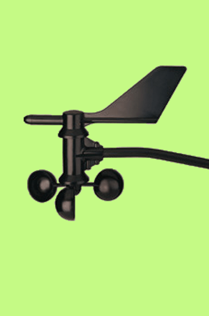
The Anemometer
Wind speed is measured with a rotating three-cup anemometer and wind direction
by a weather vane.Because winds near the surface are often gusty, both the average wind speed over a period of time (usually one minute) and the peak wind speed that the anemometer records within that time period are measured and recorded.
- Anemometer
-
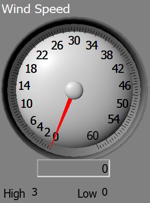
Wind Speed
Wind speed was once classified by using
the Beaufort scale which is based on people’s observation of specifically defined wind effects on the sea or trees.Record wind speeds have topped 200 mph.
Unit of measure = miles per hour
- Anemometer
-
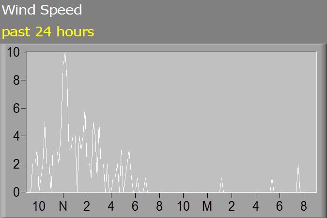
Wind Speed
Wind speed, which is influenced by pressure gradients, jet streams and local weather conditions, can affect aircraft operations, construction projects and even the growth and metabolism rate of many plant species.
Unit of measure = miles per hour;
x asis is the hour of the day (M = midnight) - Anemometer
-
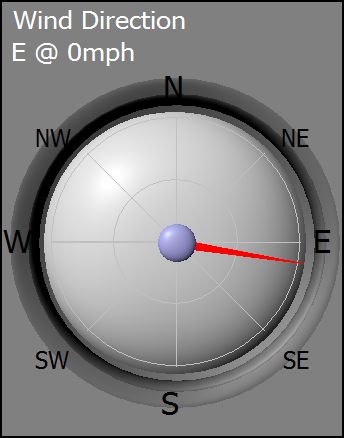
Wind Direction
The wind direction is the direction from which the wind is blowing. For example, a NW wind is blowing from the NW toward the SE.
Wind directions are recorded to the nearest of the sixteen points of the compass.
- Anemometer
-
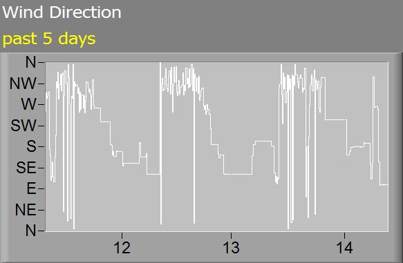
Wind Direction
In the Rogue Valley, winds are influenced by the valley’s geographic orientation.
As winds blow up or down the valley, the data will reflect winds blowing predominantly from the southeast or the northwest.
x axis is the day of the month
- Anemometer
-
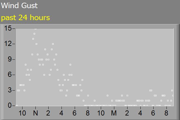
Wind Gust
During intense winter storms in the Rogue Valley, wind gusts in excess of 60 mph have occurred.
Unit of measure = miles per hour;
x axis is hour of the day - Anemometer
-
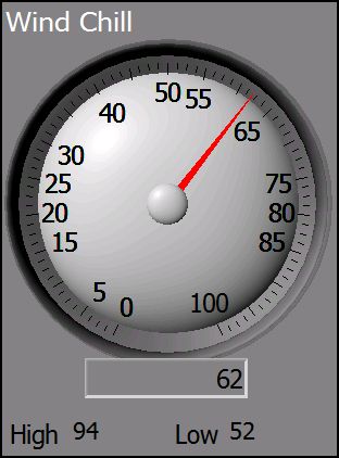
Wind Chill
Wind chill is the apparent air temperature as it is felt on exposed skin. This temperature is also sometimes expressed as a "feels like" temperature. The faster the wind speed, the quicker the body cools. As the air temperature falls, the chilling effect of any wind that is present increases.
Unit of measure = °F
- Anemometer
-
Green Living Tip
Because wind directly affects the evapotranspiration (ET) rate, you can conserve water during the summer by planting a wind break.
Not only will a wind break protect other vegetation, but it can also lower home heating needs in the winter by reducing
wind chill.
